Blog

Million Dollar Highway – not for those who don’t like heights (that would be me!)

We left the fairgrounds Friday morning. Our destination was about 150 km north up what is called the Million Dollar Highway. Why is it named that? Is it for the million dollar views? Is it because of the cost to build a mile was a million dollars? Is it because after you drive it you won’t go back over it even if someone gives you a million dollars?

This section of Hwy 550 was built in the 1920s and 30s it has three mountain passes. Red Mountain Pass is the highest at over 11,000’. The other two are Molas Pass and Coal Bank Pass. With steep grades and hairpin curves, it certainly isn’t for everyone. Pulling a 33’ trailer up and down the grades makes it even more challenging – you need to know how to do it or your brakes will get too hot.

Coal Bank Pass

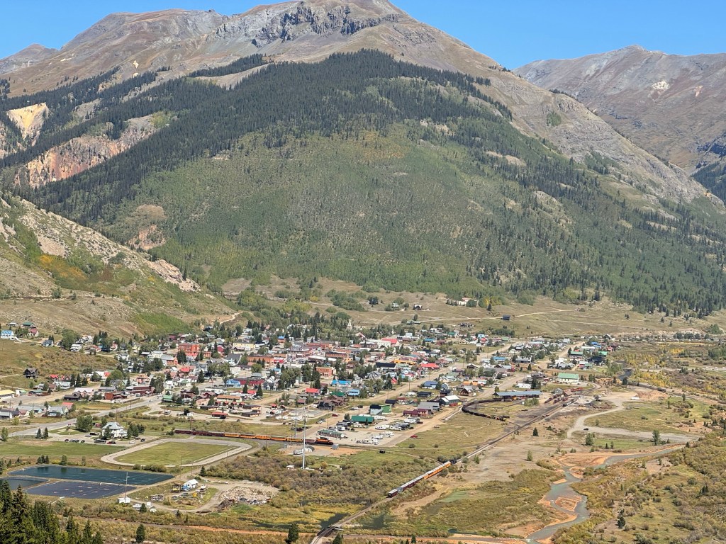
Along the way we passed through the town of Silverton, where we had picked up a pizza while out jeeping.

Coming down the mountain into Silverton.
Remnants of old mining days
Beautiful colours in the mountains. Lucky to have such a clear blue sky!
The road is literally cut into the side of the mountain. Many places there are no guardrails either.

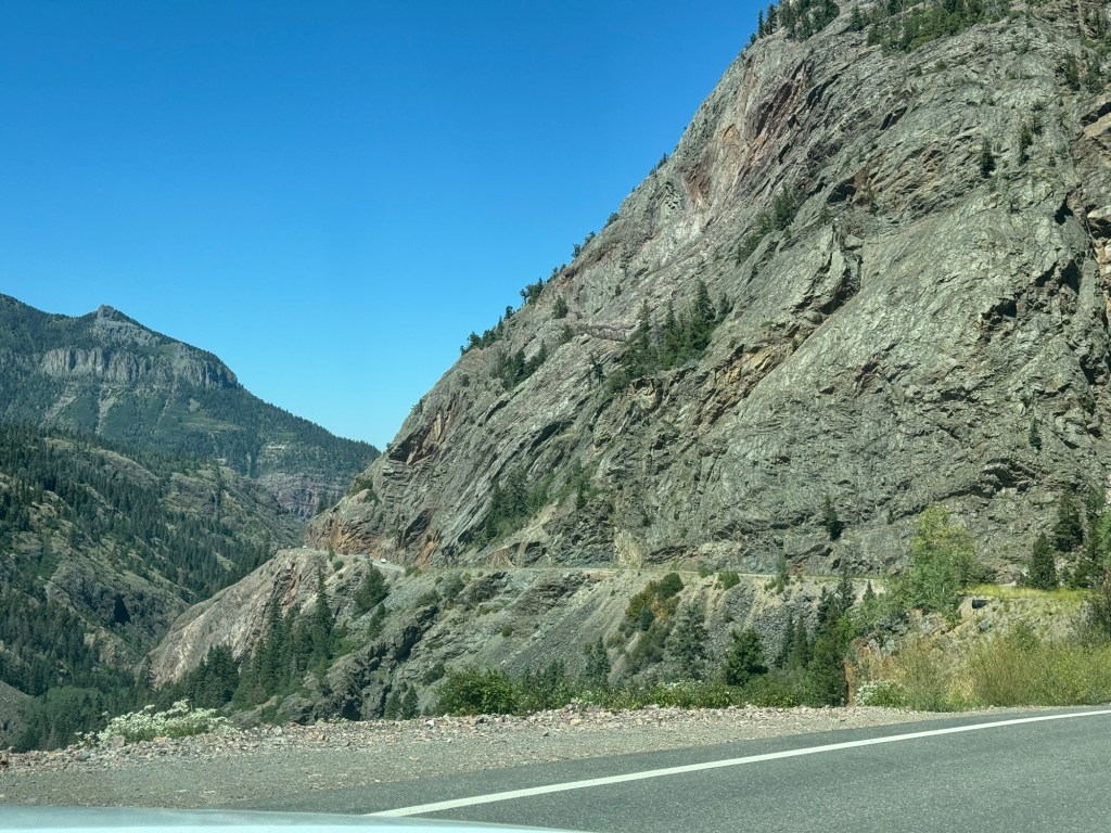
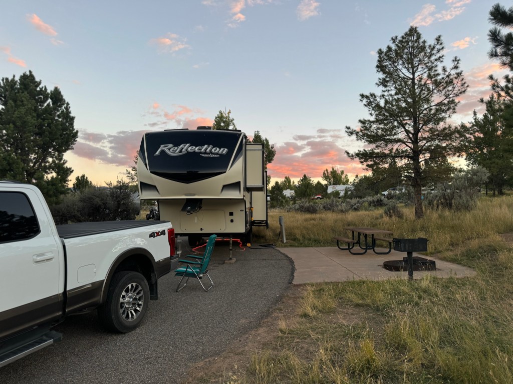
We heard going north on the Million Dollar Highway is the better direction – you are driving on the mountain side and not looking over the edge as much. I can say I was happy to arrive at our campsite. It’s full on Friday night but we have a suitable site for the trailer.

Ridgway State Park site 47

We also were in time to have an early supper and head back to Ouray for a dip in their Hot Springs. What a wonderful way to relax before bedtime!

Durango and a day trip

Wednesday morning we had a leisurely breakfast before heading back down the road to the Fairgrounds in Durango where our site was empty and we could set up. We were basically in a parking lot beside their maintenance area – no shade and lots of trucks in and out all day and evening.

After a bite of lunch, we headed into the town for some shopping. Paul got the propane tank refilled while I headed to the grocery store – this time a Walmart where I could pick up a few household items on our list.

Thursday morning Paul headed out before 6:30 to get in line at the Ford express oil service for an oil change for the truck.

I got breakfast ready and packed a lunch so we could head out for another scenic drive when he returned. Unfortunately he wasn’t first in line so it was about 9 am before he returned.

This time we headed south of Durango on a back road for part of a drive called “Tracks across Borders”. Our main destination was the Chimney Rock National Monument we had passed earlier in the week.

Chimney Rock on left and Companion Rock on the right

At certain times of the year, the moon rises between the two rocks. It was felt this may have held some significance to these peoples.

Ancient Puebloans settled at Chimney Rock around 1000 AD.

Some excavating has discovered parts of the stone structures built by this group. The ancient Puebloans were creative capturing rain water when it came, but likely had to make daily trips down 1000’ in elevation and travelling 2 miles round trip in order to keep their supply of water. This group only lived about 50 years in this location before moving on to other regions of the four corners. There were a couple of trails where we could see these remnants. Paul did the longer one while I made it around the shorter one.

The great kiva – a community gathering place

Tomorrow, Friday, we head out and go north up the Million Dollar Highway to our next stop.